
Info
 Ten blog rowerowy prowadzi pawros z miasteczka Łódź.
Mam przejechane 3442.56 kilometrów w tym 1092.00 w terenie.
Jeżdżę z prędkością średnią 14.75 km/h i się wcale nie chwalę.
Ten blog rowerowy prowadzi pawros z miasteczka Łódź.
Mam przejechane 3442.56 kilometrów w tym 1092.00 w terenie.
Jeżdżę z prędkością średnią 14.75 km/h i się wcale nie chwalę.Suma podjazdów to 0 metrów.
Więcej o mnie.

Moje rowery


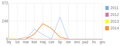
Wykres roczny
Archiwum bloga
- 2014, Lipiec1 - 0
- 2014, Czerwiec4 - 0
- 2014, Maj6 - 0
- 2014, Kwiecień3 - 0
- 2013, Marzec1 - 0
- 2013, Styczeń4 - 4
- 2012, Marzec1 - 1
- 2011, Lipiec9 - 0
- 2011, Maj3 - 0
- 2011, Kwiecień4 - 1
- 2010, Listopad1 - 0
- 2010, Październik8 - 0
- 2010, Wrzesień6 - 0
- 2010, Sierpień4 - 0
- 2010, Czerwiec2 - 0
- 2010, Maj2 - 0
- 2009, Grudzień1 - 0
- 2009, Sierpień2 - 0
- 2009, Czerwiec1 - 0
- 2008, Wrzesień2 - 0
- 2007, Maj4 - 0
zagranica
| Dystans całkowity: | 1800.28 km (w terenie 513.00 km; 28.50%) |
| Czas w ruchu: | 112:52 |
| Średnia prędkość: | 12.43 km/h |
| Maksymalna prędkość: | 50.00 km/h |
| Liczba aktywności: | 33 |
| Średnio na aktywność: | 54.55 km i 4h 20m |
| Więcej statystyk | |
- DST 45.00km
- Teren 10.00km
- Czas 02:22
- VAVG 19.01km/h
- Sprzęt SPARK
- Aktywność Jazda na rowerze
Punta del Palma, Bella Vista, El Tablazo
Wtorek, 7 września 2010 · dodano: 09.09.2010 | Komentarze 0
Pokaż trasę GPS" width="600" height="400" frameborder="0" scrolling="no" marginheight="0" marginwidth="0"></iframe>" width="600" height="400" frameborder="0" scrolling="no" marginheight="0" marginwidth="0"></iframe>" width="600" height="400" frameborder="0" scrolling="no" marginheight="0" marginwidth="0"></iframe>">Opis linka
" title="GPSies - Punto del Palma, Bella Vista, El Tablazo"><img src="http://www.gpsies.com/images/linkus.png" border="0" alt="GPSies - Punto del Palma, Bella Vista, El Tablazo" /></a>">Opis linka[/url">
[url=[url=http://photo.bikestats.eu/zdjecie,131646,puerto-miranda-do-punto-del-palma-bella-vista-wenezuela.html]
Puerto Miranda, do Punto del PALMA, Bella Vista. Wenezuela
© Pablo
Punto del Palma, Wenezuela.
© Pablo
Posterunek Policji w Sabaneta del Palmas. Wenezuela
© Pablo
Punto del Palma. Na plaży Jeziora Maracaibo.
© Pablo
Punto del Palma, Wenezuela.
© Pablo
Sabaneta del PALMA.
© Pablo
Kościół w El Jobitero, Wenezuela.
© Pablo
- DST 63.30km
- Teren 10.00km
- Czas 03:30
- VAVG 18.08km/h
- Aktywność Jazda na rowerze
Do Boca del Palmer
Sobota, 28 sierpnia 2010 · dodano: 29.08.2010 | Komentarze 0
[img">[url=http://photo.bikestats.eu/zdjecie,130247,w-joaquin-na-50-km-rundy-do-zazarity.html]
 " title="W Joaquin na 50 km rundy do Zazarity." width="448" height="336" />
W Joaquin na 50 km rundy do Zazarity.© Pablo
src="" width="600" height="400" frameborder="0" scrolling="no" marginheight="0" marginwidth="0]</iframe>" width="600" height="400" frameborder="0" scrolling="no" marginheight="0" marginwidth="0"></iframe>" width="600" height="400" frameborder="0" scrolling="no" marginheight="0" marginwidth="0"></iframe>" width="600" height="400" frameborder="0" scrolling="no" marginheight="0" marginwidth="0"></iframe>" width="600" height="400" frameborder="0" scrolling="no" marginheight="0" marginwidth="0"></iframe>" width="600" height="400" frameborder="0" scrolling="no" marginheight="0" marginwidth="0"></iframe>" width="600" height="400" frameborder="0" scrolling="no" marginheight="0" marginwidth="0"></iframe>" width="600" height="400" frameborder="0" scrolling="no" marginheight="0" marginwidth="0"></iframe>" width="600" height="400" frameborder="0" scrolling="no" marginheight="0" marginwidth="0"></iframe>" title="GPSies - Przez Boca del Palmar"><img src="http://www.gpsies.com/images/linkus.png" border="0" alt="GPSies - Przez Boca del Palmar" />[/url][/img]

 " title="W Joaquin. 50km." width="358" height="336" />
W Joaquin. 50km.© Pablo
 " title="W drodze z Boca del Palmar do Zazaridy. Wenezuela" width="600" height="450" />
W drodze z Boca del Palmar do Zazaridy. Wenezuela© Pablo
 " title="BOCA DEL PALMAR, LAS FLORES, WENEZUELA." width="600" height="440" />
BOCA DEL PALMAR, LAS FLORES, WENEZUELA.© Pablo
 " title="Kociół Katolicki w Boca del Palmar" width="600" height="450" />
Kociół Katolicki w Boca del Palmar© Pablo
 " title="W LAs Flores. Wenezuela. Bogdan, tylko ostrożnie!" width="501" height="600" />
W LAs Flores. Wenezuela. Bogdan, tylko ostrożnie!© Pablo
 [/url]" title="Na 48 km w drodze do el Tablazo przez Bella Vistę." width="448" height="287" />
Na 48 km w drodze do el Tablazo przez Bella Vistę.© Pablo
 " title="Na 48 km w drodze do el Tablazo przez Bella Vistę." width="448" height="287" />
Na 48 km w drodze do el Tablazo przez Bella Vistę.© Pablo
- DST 55.41km
- Teren 10.00km
- Czas 03:03
- VAVG 18.17km/h
- Sprzęt UNIBIKE EVOLUTION
- Aktywność Jazda na rowerze
Lhota to Lhota przez Kudowę Teplice nad Metui.
Sobota, 22 sierpnia 2009 · dodano: 06.09.2010 | Komentarze 0
Pokaż trasę GPS" width="600" height="400" frameborder="0" scrolling="no" marginheight="0" marginwidth="0"></iframe>" width="600" height="400" frameborder="0" scrolling="no" marginheight="0" marginwidth="0"></iframe>" width="600" height="400" frameborder="0" scrolling="no" marginheight="0" marginwidth="0"></iframe>" width="600" height="400" frameborder="0" scrolling="no" marginheight="0" marginwidth="0"></iframe>" width="600" height="400" frameborder="0" scrolling="no" marginheight="0" marginwidth="0"></iframe>" width="600" height="400" frameborder="0" scrolling="no" marginheight="0" marginwidth="0"></iframe>" width="600" height="400" frameborder="0" scrolling="no" marginheight="0" marginwidth="0"></iframe>" width="600" height="400" frameborder="0" scrolling="no" marginheight="0" marginwidth="0"></iframe>" width="600" height="400" frameborder="0" scrolling="no" marginheight="0" marginwidth="0"></iframe>" width="600" height="400" frameborder="0" scrolling="no" marginheight="0" marginwidth="0"></iframe>" width="600" height="400" frameborder="0" scrolling="no" marginheight="0" marginwidth="0"></iframe>" width="600" height="400" frameborder="0" scrolling="no" marginheight="0" marginwidth="0"></iframe>" width="600" height="400" frameborder="0" scrolling="no" marginheight="0" marginwidth="0"></iframe>" width="600" height="400" frameborder="0" scrolling="no" marginheight="0" marginwidth="0"></iframe>" width="600" height="400" frameborder="0" scrolling="no" marginheight="0" marginwidth="0"></iframe>" width="600" height="400" frameborder="0" scrolling="no" marginheight="0" marginwidth="0"></iframe>" width="600" height="400" frameborder="0" scrolling="no" marginheight="0" marginwidth="0"></iframe>" width="600" height="400" frameborder="0" scrolling="no" marginheight="0" marginwidth="0"></iframe>">Opis linka
W Radkowie na torturach
© Pablo
" title="GPSies - Kudowa Zdrój runda przezTeplice n. Metui"><img src="http://www.gpsies.com/images/linkus.png" border="0" alt="GPSies - Kudowa Zdrój runda przezTeplice n. Metui" /></a>">Opis linka[/url">
W Radkowie na torturach© Pablo
 " title="Przejście graniczne w Lhocie." width="600" height="337" />
Przejście graniczne w Lhocie.© Pablo
" title="W Radkowie na torturach" width="600" height="337" />W Radkowie na torturach© Pablo
 " title="W Czernej, Czechy." width="600" height="337" />
W Czernej, Czechy.© Pablo
 " title="Hronow, Czechy" width="600" height="337" />
Hronow, Czechy© Pablo
 " title="W Myte napis na resteuracji." width="600" height="337" />
W Myte napis na resteuracji.© Pablo
 " title="Po czeskich drogach. Wycieczka do Teplic nad Metui." width="600" height="337" />
Po czeskich drogach. Wycieczka do Teplic nad Metui.© Pablo
 " title="Do Bely'ego, Czechy." width="600" height="337" />
Do Bely'ego, Czechy.© Pablo
 " title="Zjazd do Belego. Czechy." width="600" height="337" />
Zjazd do Belego. Czechy.© Pablo
 " title="Velke Petrovice" width="600" height="337" />
Velke Petrovice© Pablo

Polite nad Metui.© Pablo